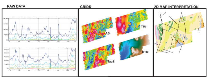
Spectrem Air – through its advanced airborne electromagnetic technology housed on one plane – uses in-house data processing tools to deliver results timeously. Our routine data processing is done during data acquisition, resulting in preliminary maps made available within hours.

Our standard processed data includes
EM channel and Total Magnetic Intensity (TMI) grids
Late Time constant (Tau) and Conductivity Depth Images (CDls)
Anomaly selections (depth, dip, conductance)
Regolith thickness map
High-resolution DTM
Radiometric grids (K, U, Th and Total Count)
Spectrem Air has a full suite of
high-end data interpretation tools, offering insightful products including
Depth to conductors
Structural and lineament maps
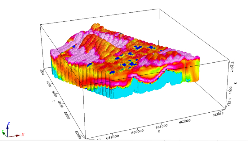
3D conductivity maps
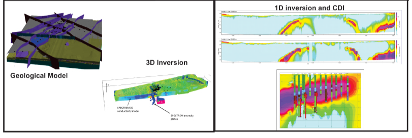
Additional deliverables would include a range of 1D, 2D and 3D conductivity and magnetic inversion models. Through the interaction with internationally acclaimed research consortia and individuals, we can continually implement the latest interpretation methods.
Our multiple data sets provide integrated 3D solutions for geological mapping, exploration targeting, go-hydrological and geoengineering applications.
Geological Mapping
The broadband nature of the SPECTREMPLUS system, including B-field STEP response processing, results in the most efficient mapping of deep-mineralized zones in conductive environments. In addition, the SPECTREMPLUS system is an ideal tool for regional and detailed geological mapping given its large footprint.
Hydrogeology and Geo-engineering
The STEP response data is not spatially filtered (as is the norm with other systems) and the stable platform results in lower system noise levels at early times. Spectrem Air’s proprietary post-processing techniques enable detailed resolution of the first 100m of the sub-surface. This makes the system ideal for shallow aquifer mapping, environmental studies, and geo-engineering.