Spectrem Air uses in-house data processing tools for 3D interpretation for accurate and reliable solid earth models.


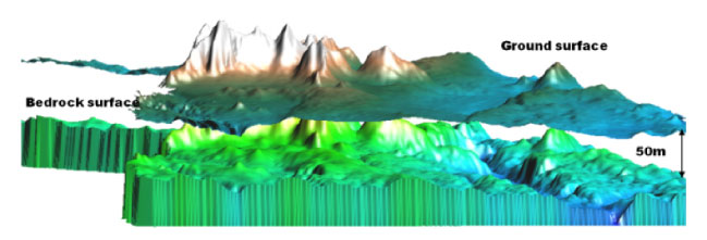
Bedrock surface as determined by processing of Spectrem data shown in 3D. An alluvial channel is clearly depicted.
Mapping Alluvial Channels
Spectrem Air’s system has been extensively used to map buried paleo-channels under conductive cover. This has been applied for buried diamond ferrous alluvial channels in South Africa, gold exploration in Africa, and geo-hydrology applications.
The product can also be used by geologists in understanding the overburden or regolith in the application of geochemistry.
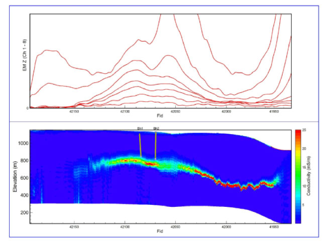
Spectrem data delineating the conductive mineralised zone to depth at the Gamsberg zinc deposit.
Deep Detection of Targets
The Spectrem conductivity depth image displayed alongside shows a mineralised conductive horizon being mapped to depths > 600m below the surface on a project in South Africa.
The borehole intersections indicate how accurately the target can be imaged. In addition, the changes in conductivity response assisted the exploration team in targeting the prospective portions of the unit.
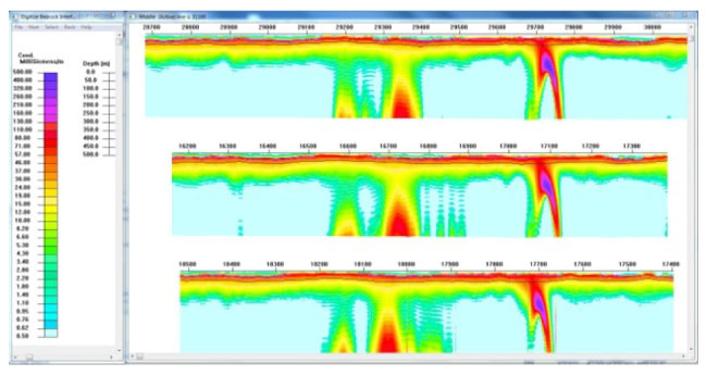
Mapping shallow and deep targets simultaneously
Spectrem Air’s system has proven successful in exploration in the copper belt under Kalahari cover. Both a shallow conductor (50 m) and deeper conductors (400 m) have been detected. In addition, the conductive overburden is well defined.
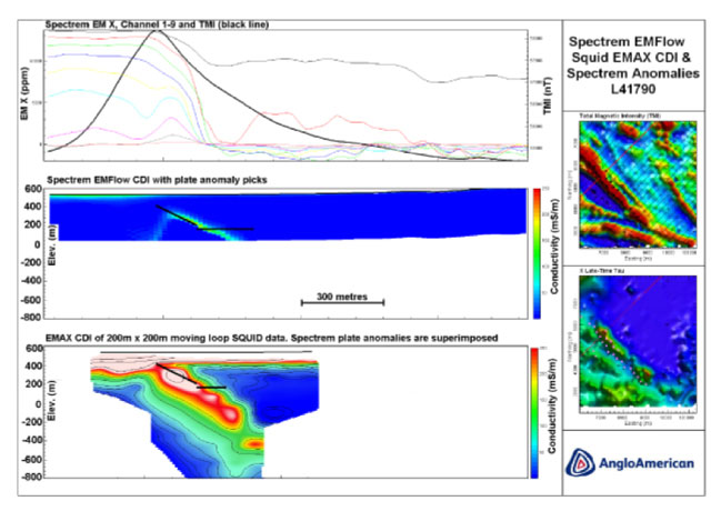
Validation of Spectrem data
Spectrem Air’s ability to map deep features has been validated by the utilisation of other techniques. This data shows plate like bodies from Spectrem modelling also observed in data collected with a ground based, moving loop SQUID electromagnetic survey.
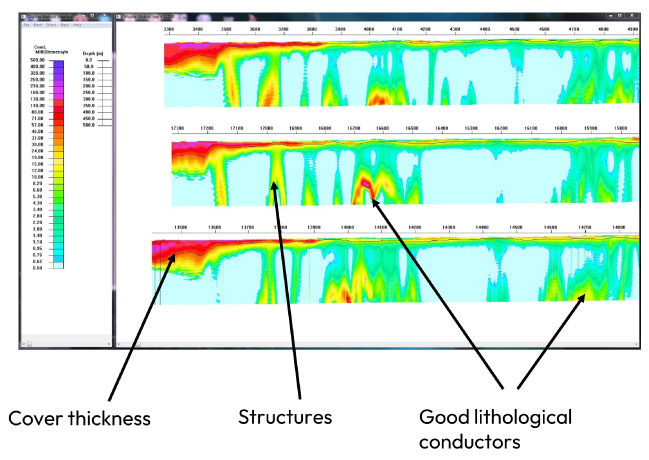
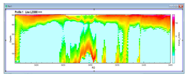
SpectremPlus AEM Surveys in Australia
Recent data collection by Spectrem in Australia has demonstrated the ability to:
- Map variation in cover thickness
- Map structures
- Define good lithological conductors at depth
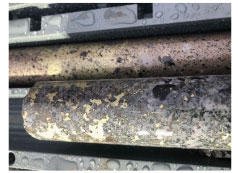
Core intersection showing coarse-grained chalcopyrite and pyrrhotite
SpectremPlus AEM Surveys in Australia
Spectrem Air conducted several large AEM surveys in the Lake Mackay region for IGO Limited.
Prodigy Gold NL (in JV with IGO) reported high grade copper (gold-silver) mineralisation intersected on the Phreaker Prospect in recently completed diamond drilling of EM conductors believed to be associated with base metal mineralization.
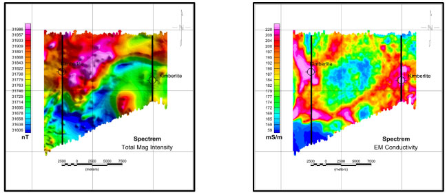
Kimberlite Diamond Exploration
The Spectrem system has been successfully deployed in Africa, and North and South America on several diamond exploration projects.
Spectrem easily detected several kimberlites around moderate conductive and thick cover. In many of the cases, the kimberlites displayed no obvious magnetic responses.
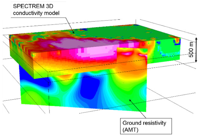
Kimberlite Diamond Exploration
A 3D conductivity model derived from Spectrem data over a kimberlite combined with a ground AMT section across the same body. The model clearly depicts the conductive target associated with the top portion of the kimberlite and is complemented by the AMT data depicting the hyperbyssal root zone of the kimberlite.
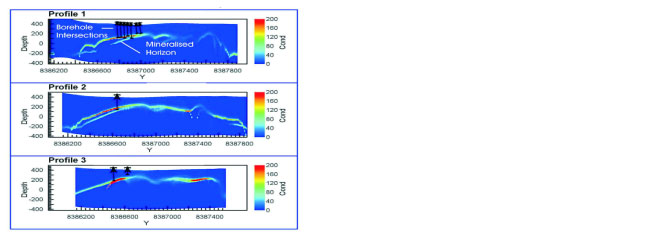
Gold Exploration
Conductivity depth images (CDI) from survey lines flown over a gold deposit. The CDIs map the feature associated with the mineralised horizon to depth and have been corroborated by borehole intersections as depicted.
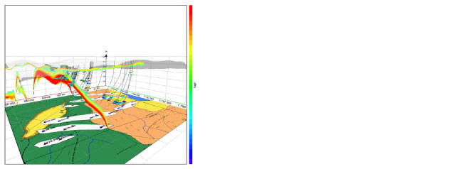
A CDI over a gold target combined with the 3D geological model and borehole assay results. The increased grade zone as verified by borehole results correlates well with the conductive target as mapped by Spectrem.
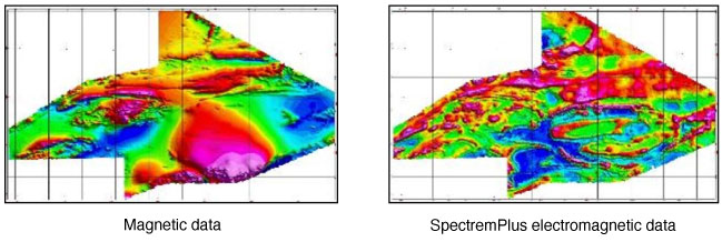
Map of electrical conductivity derived from the Spectrem system clearly depicting geological structures and trends.
The value add of SPECTREMPLUS EM data
The images below are from a Spectrem survey conducted in Namibia.
The additional geological information available from the high-resolution AEM complements and enhances the traditional magnetic survey data and greatly improves exploration focus and targeting.